Support the chase here – http://www.teamdominator.store
Connection courtesy of https://bit.ly/isptekdom
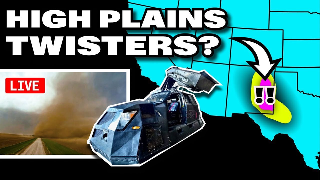
🌪️ SEVERE WEATHER OUTLOOK – SATURDAY, APRIL 26, 2025
SPC Risk Level: SLIGHT (Level 2 of 5)
Valid through 7 AM CDT Sunday
📍 Major Cities in Risk Zones
🟡 SLIGHT Risk (774K people): Midland, TX, Roswell, NM, Clovis, NM, Hobbs, NM, Ardmore, OK
🟢 MARGINAL Risk (40.9M people): New York, NY, Philadelphia, PA, Baltimore, MD, Washington, DC, Virginia Beach, VA
🌪️ Tornado Risk Zones
🟤 5% Tornado Risk: Roswell, NM, Hobbs, NM, Portales, NM, Artesia, NM, Lovington, NM
🟢 2% Tornado Risk: Shreveport, LA, Denton, TX, Midland, TX, Odessa, TX, San Angelo, TX
What the Percentages Mean
A 5% tornado risk means you have a 1 in 20 chance of a tornado occurring within 25 miles of you.
The 2% zone carries a lower but real tornado threat, especially with supercells later in the afternoon and evening.
📝 Overview
Scattered severe thunderstorms are forecast this afternoon into tonight across eastern New Mexico and parts of west Texas.
The main threats are very large hail, a couple of tornadoes, and damaging wind gusts—particularly across southeastern NM and into west TX.
⛈️ Hazards Include
🧊 Very large hail (up to 2″ or more possible)
🌪️ A couple of tornadoes, especially early evening in eastern NM
💨 Isolated damaging wind gusts with upscale-growing clusters
🕓 Timeline
🕓 Mid to Late Afternoon (3–6 PM CDT): Supercells form along the dryline/front near southeast NM and the Permian Basin
🌆 Evening (6–9 PM CDT): Greatest risk for tornadoes and giant hail across Roswell, Hobbs, and Lovington areas
🌒 Overnight (9 PM–1 AM CDT): Storms shift eastward, hail/wind threat continues into western TX
📌 Regional Notes
🟤 Eastern NM (Roswell, Hobbs): Highest potential for supercells with large hail and isolated tornadoes
🟡 West TX (Midland, Odessa): Upscale growth possible, but still severe hail and damaging wind risks
🟢 Northeast/Mid-Atlantic: Scattered storms possible with gusty winds, but limited severe threat
⚠️ Stay Weather-Aware
If you’re in or near Roswell, Hobbs, or Midland, conditions are favorable for severe supercells this evening.
Monitor weather alerts closely and be ready to shelter quickly if a warning is issued.
———————————
FOLLOW ON OTHER PLATFORMS, TIP & CONTACT ME HERE:
https://linktr.ee/reedtimmer
Team Dom Storm Recovery Info
https://linktr.ee/tdstormrecovery?
———————————
Rocket Man – @Willclay25
Chaser Follow – @EdgarTheStormChaser
Navigator – @localmanweatherofficial
Guy in the corner – @brianvotoole
Thanks to @LiveCamChaser for helping us with the webcams!!
And HUGE Thanks to RED EARTH TECH! – https://www.red-earth.tech/